
New satellite-based assessment shows 60% of districts exceed national PM2.5 limits; Indo-Gangetic region remains most polluted airshed year-round
India’s air pollution challenge is far more widespread and persistent than previously recognised, according to a new satellite-based analysis released by the Centre for Research on Energy and Clean Air (CREA).
The report reveals that harmful PM2.5 concentrations pose a year-round health threat across India’s districts, calling for urgent policy reforms that move beyond city-focused interventions.
Using high-resolution satellite data, CREA assessed annual and seasonal population-weighted PM2.5 levels across India’s districts, states, and airsheds.
The findings expose stark regional disparities and underline the need for data-driven, airshed-level strategies under the National Clean Air Programme (NCAP).
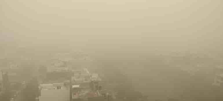
Indo-Gangetic Plain Remains Most Polluted Airshed
The seasonal analysis shows that the Indo-Gangetic airshed continues to record the highest PM2.5 levels across winter, summer, and post-monsoon seasons, remaining consistently non-compliant with India’s annual National Ambient Air Quality Standard (NAAQS) of 40 µg/m³.
The Northeast airshed has emerged as a growing concern, with states such as Assam and Tripura registering elevated PM2.5 concentrations throughout the year. During the monsoon season, all airsheds except the Northeast recorded levels below the national standard — but the sharp rebound in pollution post-monsoon indicates that persistent emissions, not weather patterns, drive India’s air quality crisis.
“Without airshed-based governance frameworks, satellite monitoring integration into NCAP, sectoral emission targets, and accountability mechanisms, millions in non-metropolitan India will remain locked out of clean air policy and locked into chronic pollution exposure,” said Manoj Kumar, Analyst at CREA.
He added that CREA is developing daily PM2.5 concentration maps, which will soon be publicly available to help policymakers, researchers, and citizens track pollution trends in real time.
District-Level Findings: 60% Exceed National Limits
The annual district analysis paints an alarming picture:
- 447 out of 749 districts (60%) exceed India’s annual PM2.5 standard.
- None meet the WHO guideline of 5 µg/m³.
- Assam and Delhi together account for nearly half of the 50 most polluted districts.
- Delhi, Tripura, Punjab, Haryana, Himachal Pradesh, Meghalaya, and Chandigarh showed 100% district-level exceedance in all seasons except monsoon.
Season-wise exceedance of the NAAQS shows the magnitude of the challenge:
- Winter: 616 districts (82%)
- Summer: 405 districts (54%)
- Monsoon: 74 districts (10%)
- Post-monsoon: 566 districts (75%)
“India’s clean air challenge can no longer be viewed through the narrow lens of city pollution or winter smog,” Manoj said. “Poor air quality persists through most of the year, affecting nearly every region of the country.”
State-Level Trends: Delhi Remains Most Polluted
Of the 33 states and union territories assessed:
- 28 had at least one district exceeding the annual NAAQS.
- None met the WHO annual guideline.
- Delhi ranked as the most polluted state, recording an annual population-weighted mean PM2.5 concentration of 101 µg/m³ — 2.5 times the national standard and 20 times the WHO guideline.
Southern states, which currently remain below the NAAQS, have a strong opportunity to advance cleaner-air policies by targeting WHO interim standards through region-specific limits.
Assessment Coverage
The analysis excludes Ladakh, Andaman & Nicobar Islands, and Lakshadweep due to insufficient ground monitoring data. The remaining 749 districts across 33 states and UTs were included. Seasons were defined as:
- Winter: Dec 2024–Feb 2025
- Summer: Mar 2024–May 2024
- Monsoon: Jun 2024–Sep 2024
- Post-monsoon: Oct 2024–Nov 2024